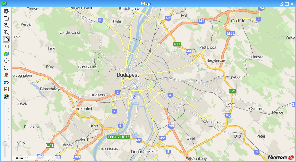
The map can be used through a user interface, which is located on the left side of the map, in the column of the controls.
These controls are the following, top-down:
Settings menu. It corresponds with Help menu -> Settings option.
Map layers: Layers displayed on the map (the name of the map used, points of interest, tasks, tracked vehicles). If more, than one map is open (e.g. replay on map and small map), you can move the map layers between them by holding down the left mouse button and dragging them (keep the “Ctrl” key pressed if you want to copy the layers instead of moving).
Zoom out: In this mode, you can switch to a distant view when clicking on the map. It can be replaced with the mouse wheel.
Zoom in: In this mode, you can switch to a closer view when clicking on the map or zoom in the selected area by dragging the lasso. It can be replaced with the mouse wheel.
Hand: In this mode you can grab the map and drag it with the mouse in any direction, and you can zoom using the mouse wheel.
Ruler: You can measure distances on the map with this tool. Click a location, and then hold the mouse button and drag to display the distance to the selected point.
Map: This option allows you to choose from different type of maps e.g. Europe, Hungary, OpenStreetMap.
Magnifying glass: It gives an overview of the current view. A blue rectangle shows the current view on the scaled-down version of the selected map, but if the zoom is very high, then a red line shows the current latitude and longitude coordinates. (This function helps to establish the position of the currently viewed map section within the entire map with one click.)
Save view: To save views, right click on the map and select “Save view...” (select a location, e.g., Budapest and its surroundings and save it with right click and “Save view”; you can even set it as the default view. As a result, this view will be displayed every time you open the map of Hungary.), and these views may be selected later from the pull-down menu above and so you don’t have to look for saved towns etc.
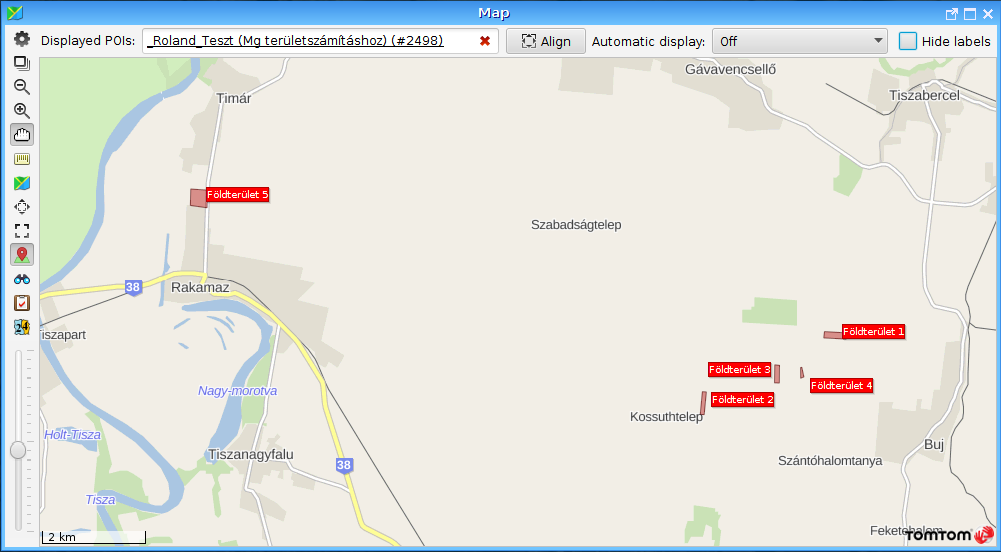
Map with a red pin: Visibility of points of interest. You can select a group of points of interest from the drop-down menu. Text labels can be hidden and one group of point of interest can be displayed on the map at one time.
Binoculars: You can search for a specific location on the map. This may be a specific address, locality or anything else (e.g. towns, roads, bridges).
Writing board with red check mark: The display related to tasks can be set (visibility of tasks, show/hide text labels, draw/hide all lines). For the management of tasks, the automated web service system is needed.
Postal districts: This shows the distribution of postal districts in Europe. More information here: Postal districts
Slider: You can select the zoomed in/out view with the slider on one step. Move the slider up to zoom in, and move it down to zoom out on the map.
When the “Yellow X on the globe” button is selected, you can zoom on a group of points of interest with the “Align” button. If you double-click on this button, the program will zoom to the selected point on the map. If multiple points are under your mouse pointer, double click will zoom to the selected points on the map.
If you want to set a group of points of interest as the default, use the “Save” button located to the right to the “Align” button.
The program can display the map in a variety of views, e.g. you can see the route taken by a vehicle or you can simultaneously track several vehicles. The map can always be controlled in a similar way.
The scale is shown in the bottom left corner of the map.
Click with the right mouse button on the map to select from the options in the pop-up menu. These options are as follows
Settings...
Save map as image... (PNG format)
Add point of interest... (you can save the current point as a point of interest)
Get the exact address (zip code, city, street, house number, if included in the map database)
Save view as default (newly opened tracking windows will always start in this view)
Save view (saves the view under the name you specify, and later you can open it by clicking on the View icon)
Show point on Google Maps (you can view a particular map detail using Google Maps)
Show point on Google Maps satellite image (you can view a Google Maps satellite image of the particular point on the map)
Transparent labels (you can set the opacity of text labels on the map)
Tasks (Show/Hide)
Points of interest (Show/Hide)
Change map (those maps can be selected, on which the current point is present)
You can zoom in at any time on the map with the mouse wheel.
(C) Copyright iData Kft., 2005-2022. All rights reserved.
JavaScript errors detected
Please note, these errors can depend on your browser setup.
If this problem persists, please contact our support.